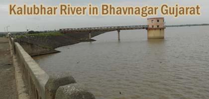
Kalubhar River in Bhavnagar Gujarat - Kalubhar Dam History - Details - Photos
Kalubhar River is located on the Kathiawar Peninsula in the western direction in Gujarat state India. Kalubhar River originates from Chamardi Village near Babra in Bhavnagar District Gujarat and flows on the eastward direction into the Gulf of Khambhat. The Kathiawar Peninsula is the part of Saurashtra region. Kalubhar River is also known as Kalab River.
The length of it is 94 kms and basin area of 1965 Sq. Kms. It comes near Kariyana village Bhavnagar District. The delta of the Kalubhar River is also known as Sonpari River. The kalubhar Dam is also located on the river having catchment area of 667 Sq. Kms. The area catchment by the dam is 667 Sq. kms. And mean rainfall of 554 mm. The nearby cities are Vallabhipur, Bhavnagar, Palitana, Sihor, Vadia, Savar Kundla, Dombivli, Boisar, Dadra town and Safale.
The latitude of the Kalubhar River Bhavnagar District is 21⁰ 50’ and longitude of 21⁰50’. The port of Bhavnagar is a tidal basin which receives the ships for the transportation of goods. Kalubhar River enters from the North direction about 3 miles beyond. The kalubhar River is very important for nearby cities and villages because it provides the water for the use of our daily life.
In the rainy season the water increases because new water comes in the river from the other river. The view of the river is very beautiful in the monsoon. The nature and beauty of the kalubhar River Gujarat is wonderful. |
